Photo courtesy of Tom Huynh
The Sacramento Railyards area has a long and complex history. While it’s known for the role that it played in the development of the Transcontinental Railroad, there’s more to the story of The Railyards.
Local historian and Confluence Tours guide Andrew McLeod has extensively studied the hidden history of The Railyards area, exploring the area’s pre-railroad past and uncovering the hidden history of one of Sacramento’s oldest neighborhoods.
“We should find ways to honor the forgotten history of The Railyards,” he says. “But at present we have lost more than we have kept about the site’s origins – including its original name.”
Come along as Confluence Tours uncovers the hidden history of The Railyards.
More Than Just Railyards, by Andrew McLeod
The site’s longest and best-known use was indeed as a hub for railroad operations, but it also contains the forgotten birthplace of Sacramento: The western edge of The Railyards was an old riverfront settlement, before the Gold Rush and into the 20th Century. This original neighborhood was eventually lost to the expansion of the railroad. Here’s how Sacramento’s first neighborhood came to be.
Sacramento’s Original Waterfront
Sacramento lies at the confluence of two great rivers: Its namesake is a navigable waterway that provided access to the gold-rich American Fork and overland trails from the east. This intersection of water and land routes helped overcome a poor location and allowed a city to grow in the middle of a vast wetland.
While most people think of Old Sacramento as the original waterfront, in fact the city began just upstream, near where The Railyards now is taking shape. The modern city’s street network – originally a real estate scheme called “Sacramento City” – was in fact the second chapter of our city’s story. This surprising fact is first suggested by street names: The Grid’s modern waterfront begins awkwardly at I Street, as the alphabet’s first eight letters are forgotten along with our second river.
Before the American River was moved north, for flood control purposes, it met the Sacramento River just upstream from Old Sacramento – right at the site where a new bridge is now planned at Railyards Boulevard. Here, a set of irregular blocks hugged the banks of both rivers.
These original streets and parcels appeared in the 1854 city tax book as “Slater’s Addition” – and are noted as “American Fork Addition” on the official city map from that same year.
“Addition” is an odd label for a community that predated the city itself. We might more appropriately call the place “Older Sac.”
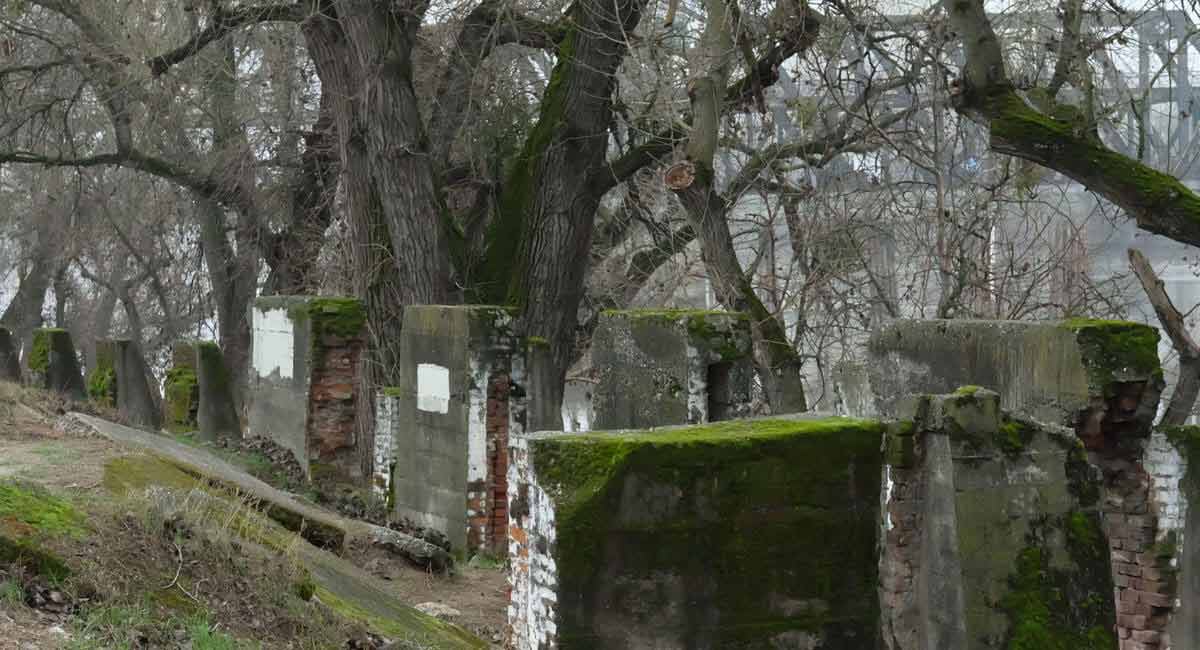
 Little remains of Sacramento’s original waterfront except foundations and one derelict building, located just upstream from the I Street bridge. These ruins may include the foundation of the 1854 Gas Works building, which first provided light to the growing city; its construction required half a million bricks.
Photo courtesy of Meghan Vanderford
Settling in a Water World
Settlement started in Older Sac because riverbanks were once the best dry ground on the valley floor. Sacramento is notoriously flat and flood-prone, so a few feet of elevation made a huge difference in flood frequency and duration.
To understand where people lived before the valley was transformed into farmland and urban sprawl, we must understand Sacramento’s underlying topography: Rivers scour material out of the Sierra Nevada, then deposit them in vast mounds called alluvial fans, built by shifting tributaries.
Paradoxically the valley’s rivers are often higher than the surrounding land, flowing between natural levees built up over millennia. When floods occur, the rivers overflow these levees. As the water spreads and slows, sediment drops and builds up the levees while the water flows on into flood basins – once known as the Inland Sea.
Any sensible people would naturally gravitate to these levees, which separated flowing water from still, and offered both transportation and abundant natural resources. Before the time of European exploration in the late 18th century, the indigenous Nisenan people often lived on the levees, sometimes atop artificial mounds that provided precious feet of elevation gain.


6 Events that Changed the Shape of California
Think you know the history of California? Here are six events that shaped the Golden State into the place it is today.

Sacramento’s Urban Origins
The first European settlers laid out a small waterfront at the confluence, before the Gold Rush. This patch of solid ground was the toehold from which land speculators led by Sam Brannan laid out “the Grid” – an audacious land scheme called Sacramento City. They sought their fortune dealing in swamplands claimed by Johann Augustus Sutter, who meanwhile promoted the growth of Sutterville, on high ground several miles downstream.
Sacramento City was an ambitious project involving the precise survey of thousands of parcels; those engaged in the venture had to eat, drink and sleep somewhere. The vast grid of Sacramento City spread from Older Sac, not Sutter’s Fort; the latter was miles from town, on an isolated mound surrounded by sloughs. The land under the fort was parceled up for sale, and even cut in half by 27th Street.
The speculators’ vast scheme outlasted the settlement that birthed it, and the original Sacramento River waterfront remains only as an isolated strip of ruins. The mostly residential American River waterfront is now gone, but part of this neighborhood survived at least until 1915, when some of the original streets and homes still appeared on detailed maps. A 1915 Sanborn Insurance map reveals a strip of warehouses and homes still wrapping around the expanding railyards, following old 1st Street out to Sycamore.
Older Sac remained a neighborhood for nearly half of our city’s history – and it remained a key industrial strip for decades after that. No visible trace of Older Sac residences has been uncovered at this time.
The Lost Neighborhood
So who lived and worked in the Sacramento’s first neighborhood?
Sacramento City’s 1851 directory included nearly a dozen entries for Older Sac, including the Sacramento Steam Mill, the Railroad Hotel, a soda factory, a brewer and three grocers. Residents included Phil Heek the baker, Dr. H. Park, a foundryman named Stow, and the prominent speculator Julius Wetzlar.
Critics of sprawl often live in the communities around which sprawl occurs, and residents may also have included Dr. Charles Robinson, who led the Sacramento Settlers’ Association in its struggle against evictions from the land we now know as the Grid. His cabin, torn down as he challenged Sutter’s title, has been described as sitting on the levee, north of I Street. Likewise, Z.M. Chapman, whose eviction was a key event in the escalation toward the 1850 uprising known as the Squatters’ Riot, claimed 160 acres near where 5th and 6th Streets once met the river, on The Railyards’ northern edge.
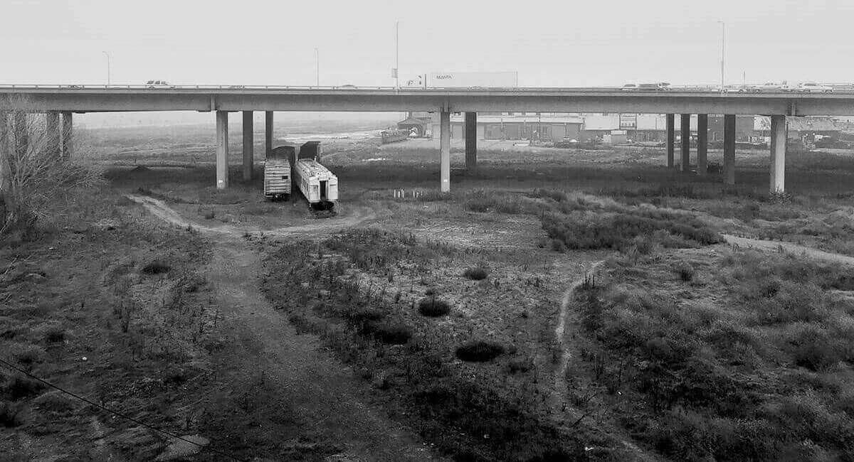
 The original settlement site is now a vast wasteland on the edge of The Railyards.
Photo courtesy of Tom Huynh
Excavating the Origins of The Railyards
In its long and complex history, the site of The Railyards has evolved and shaped Sacramento time and again. From its beginnings as one of the oldest neighborhoods in Sacramento to its transformation into the largest industrial complex in the west. Now, The Railyards is returning to its roots as it is transformed back into a riverfront neighborhood, where Sacramento residents can once more live and work.
For decades the site remained empty and unused while extensive cleanup was conducted around the core shops area to remove pollution. All that earthmoving to remove contaminated dirt has yielded its share of industrial and railroad-related artifacts, ranging in size from ceramics, bottles, and cans up to a multi-ton anvil and even car-sized locomotive boilers.
As construction moves forward in The Railyards, it remains to be seen if additional artifacts will be excavated that reveal even more about the residents and business owners who once occupied Older Sac.
And while the old settlement sites on The Railyards’ fringes may not require such a dramatic physical excavation, the process of re-settling Older Sac invites us to reexamine its relationship to our city as we excavate Sacramento’s true point of origin at the old confluence.
For more information about Older Sac and Sacramento’s hidden history, visit Confluence Tours.